


")


")

")


 from Täschalp")


- Total elevation gain: 761 meters
- Duration: 5 hours 30 minutes
- Lowest point: Täsch (1,449 m) / Highest point: Täschalp (2,210 m)
- Difficulty: 2/5 (elevation gain) / Technical: 1/5
In Täsch in the valley, the last stop before Zermatt and the place where you have to park your car, we leave it at the station car park, the starting point for our hike. We walk back up through the village to find the Europaweg hiking trail leading to Täschalp. This trail used to also lead to Zermatt, but the Himalayan footbridge over the Grabengufer scree slope is now closed for safety reasons.
We begin climbing through the forest to a clearing – ideal for a picnic if you set off late in the morning – with a water source and a huge cross, like those often found along hiking trails in Switzerland. We then head back into the forest until we reach the crossroads where the trails lead to Zermatt (closed) on one side and Ottavan (Täschalp) or, further on, Grächen on the other.
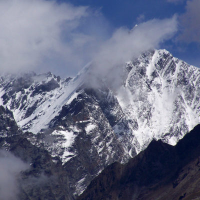
A path runs along the ridge below and offers splendid views, particularly of the Weisshorn, which rises to 4,505 m and is the fifth highest peak in the Swiss Alps, separating the Zermatt valley from the Val d’Anniviers. Although somewhat cloud-covered, the immaculate whiteness of its summit contrasts beautifully with the green valleys of Täsch and Randa.
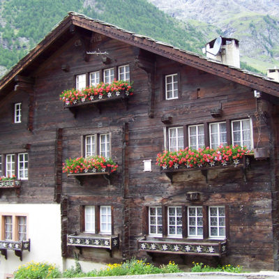
After a little over three hours of climbing, you finally arrive at Täschalp, the starting point for many treks that often require specific equipment and a good dose of motivation, especially for the 8:45 a.m. hike to Grächen. After a quick tour of the hamlet, a visit to the beautiful Täschalp chapel and perhaps a refreshing drink on the restaurant’s sunny terrace, we descend to Täsch via the same route we took on the way up.
The Täsch-Täschalp hike was completed in good weather on July 20, 2011.
This map shows the most direct route (Biketour), but we took the Europaweg route, which is a little longer but passes through a more picturesque and peaceful forest. We recommend that you take the SWISSTOPO paper map at a scale of 1:25,000 for this hike (1328 RANDA). Always be careful and plan ahead when hiking. Topexpos Voyages and the author of this guide cannot be held responsible for any accidents or inconveniences that may occur on this route.
Click on the picture to enlarge it and discover its caption.