


")
- Cumulative ascent: 430 meters
- Duration: 3 hours
- Low point: Praia do Prainha (6 m) / High point: Ponta do Furado (110 m)
- Difficulty: 1/5 / Technique: 1/5
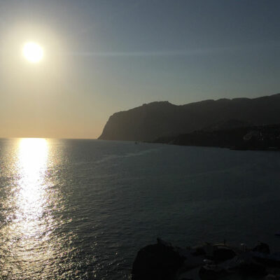
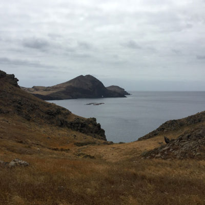
At the very eastern end of Madeira Island lies the magnificent Ponta di São Lourenço (Saint Lawrence Point), distinguished from the rest of the island by its semi-desert climate and ground vegetation. There are no trees here, and few animals apart from the Madeira lizard, which basks in the sun on the many rocks. This volcanic peninsula of basalt and limestone sediments has been classified as a nature reserve since 1982. The starting point is the Abra Bay parking lot, which can be reached by car or by taking the 113 bus direct from Funchal. The hike is relatively easy and safe, so it’s very popular in summer.
The hike begins with a downhill path, marked by log steps. This then gives way to a stony path, just wide enough for 2 people to pass each other going in opposite directions. All the way up and down to the point of São Lourenço, sometimes via steps, you can admire an almost 360° view of this arm of land jutting out into the Atlantic Ocean, its waves pounding relentlessly against the rocks.
After the narrowest part of the hike, the casa do Sardinha comes into view. It’s a welcoming place with a very pleasant terrace, ideal for a break before the climb to the top of Furado peak. Don’t forget to bring water and a hat, as shade is extremely rare on this hike. A swimsuit is also useful, as the Praia do Prainha beach offers a refreshing break.
The hike to São Lourenço Point was made on August 18, 2018.
Click on the picture to enlarge it and discover its caption.
We recommend you take along the 1:50000 paper Kompass map of this hike (234 – Madeira). Always exercise caution when hiking. Topexpos Voyages and the author of this fact sheet cannot be held responsible for any accident or inconvenience that may occur on this tour.